

 Add Us As A Trusted Google Source
 Few road trips in the eastern United States can match the quiet splendor of a drive along Skyline Drive in Shenandoah National Park. Stretching 105 miles along the crest of the Blue Ridge Mountains in Virginia, it is the only public road through the park and one of the most scenic drives in the country. The road connects travelers to sweeping overlooks, forested ridges, cascading waterfalls, and an abundance of wildlife that feels worlds away from the bustle of everyday life. For guests of the Iris Inn, the adventure begins practically at your doorstep because the southernmost entrance to Skyline Drive at Rockfish Gap is less than five miles away.
Before you set out, here are the key things to know:
- Skyline Drive runs 105 miles from Front Royal in the north to Rockfish Gap in the south, and takes about three hours to drive straight through without stopping.
- The entrance fee is $30 per car and is valid for seven consecutive days.
- There are four entrances to the Skyline Drive: Front Royal, Thornton Gap, Swift Run Gap, and Rockfish Gap.
- Cell service is unreliable throughout most of the park.
- Restrooms are available at Dickey Ridge Visitor Center (Mile 4.6) and Byrd Visitor Center (Mile 51).
- The drive is generally open 24 hours a day, seven days a week, though it may close temporarily for severe weather.
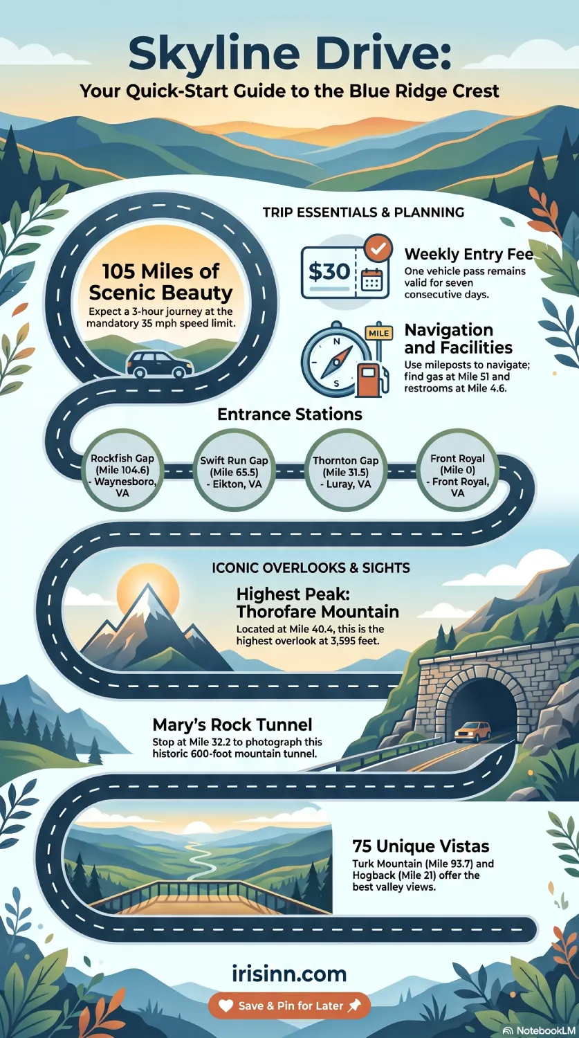
Want to share this infographic?
How long does it take to drive Skyline Drive?
The speed limit on Skyline Drive is 35 mph. The speed limit is designed for wildlife watching, fresh air, and taking in the views. If you drive without stopping, you can cover the full 105 miles in about three hours. But that would be missing the point entirely. Most visitors choose to stop at overlooks, take short hikes, or simply pull over to watch a deer graze beside the road. If you are starting from the Iris Inn, you can enter at Rockfish Gap and drive north for as long as time allows before turning back.
What does it cost to enter?
The fee to drive along Skyline Drive is $30 per vehicle, which also serves as the entrance fee to Shenandoah National Park. Your pass covers seven consecutive days, so if you plan to visit more than once during your stay, you will not need to pay again.
How do I get onto the Skyline Drive?
There are four entrances to the Skyline Drive:
- Front Royal Entrance Station (mile 0) in Front Royal, Virginia.
- Thornton GapEntrance Station (mile 31.5) near Luray, Virginia.
- Swift Run Gap Entrance Station (mile 65.5) near Elkton, Virginia.
- Rockfish Gap Entrance Station(mile 104.6) near Waynesboro, Virginia
You can choose to drive the entire Skyline Drive, turn around at an overlook, or get off at the next entrance.
When is the best time to visit?
Spring brings lush greenery and flowing waterfalls fed by snowmelt and April rains. Summer delivers long days and clear views from the higher elevations. Fall is widely considered the most spectacular time to visit, when the hardwood forests ignite with shades of red, orange, and gold. Winter brings a quieter, more solitary experience.
What are the best overlooks along the drive?
Skyline Drive features 75 named overlooks, and nearly all of them are worth a brief stop. For guests entering from the south, a few favorites stand out along the route heading north.
- Turk Mountain Overlook at Mile 93.7 offers a striking view of the cone-shaped peak with the Shenandoah Valley rolling out to the right.
- Moormans River Overlook at Mile 92 looks out over the Charlottesville Reservoir and Pasture Fence Mountain, Sawlog Ridge and, Bucks Elbow Mountain
- Rockytop Overlook at Mile 78.2 presents Patterson Ridge, Lewis Mountain, Rockytop, Loft Mountain, and the Shenandoah Valley.
- The Point Overlook at Mile 55.3 features a short, steep five-minute hike to a rocky outcrop that often feels like your own private corner of the sky.
- Franklin Cliffs Overlook at Mile 49 is ideal for those who want dramatic rocky outcrop views without any hiking. If it’s a clear day, try to spot the towns of Stanley and Luray.
- Thorofare Mountain Overlook at Mile 40.4 is the highest overlook on the entire drive at 3,595 feet.
- Tunnel Parking Overlook at Mile 32.2 is the best place to stop to grab pictures of Mary’s Rock Tunnel. This 600-foot tunnel along the Skyline Drive was built in only three months.
- Hogback Overlook at Mile 21 provides the longest uninterrupted viewpoint on the road, taking in Massanutten Mountain and the ridges of the Allegheny range stretching into the distance.
How will I know where I am along the drive?
There are mileposts on the west side of the road (they will be on your left as you head north). These posts are also used to help locate areas of interest along the drive.
Will my cell phone work along Skyline Drive?
Plan to be largely off the grid for the duration of your drive. Cell coverage is unreliable throughout most of Shenandoah National Park. There is generally better signal at Dickey Ridge Visitor Center near the northern end of the park and at some of the west-facing overlooks, but you should not count on it.
A little history
The idea for Skyline Drive was born out of a practical vision. In 1924, the Southern Appalachian National Park Committee was searching for a location for a new national park that could serve Americans living in the eastern cities, including Washington, D.C. When they recommended the Blue Ridge Mountains of Virginia, they envisioned the park’s greatest feature as a road running along the mountain. That vision became Skyline Drive.
A final word before you go
Charge your phone while you still have service, pack a cooler with snacks and water, and give yourself more time than you think you need. Remember that there is only one gas station at Big Meadows Wayside (Mile 51) and electric car charging stations at Skyland (Mile 41.7 and 42.5), so plan ahead. Skyline Drive is not a road meant to be rushed. It is a road meant to remind you what it feels like to slow down, look out, breathe deep, and be somewhere genuinely beautiful.